RasterShadedReliefRenderer
require(["esri/renderers/RasterShadedReliefRenderer"], function(RasterShadedReliefRenderer) { /* code goes here */ });esri/renderers/RasterShadedReliefRendererRasterShadedReliefRenderer produces a grayscale or colored 3D representation of the surface on an ImageryLayer or ImageryTileLayer, with the sun's relative position taken into account for shading the image. This renderer uses the altitude and azimuth properties to specify the sun's position. By default, a grayscale color ramp is used to display a hillshade elevation model.
This renderer uses a hillshading technique for visualizing terrain determined by a light source and the slope and aspect of the elevation surface. It is a qualitative method for visualizing topography and does not give absolute elevation values. This renderer provides two options for generating hillshades: traditional and multi-directional. The following images display an elevation model using the traditional hillshade type, followed by the multi-directional hillshade type.
| Traditional | Multi-directional |
|---|---|
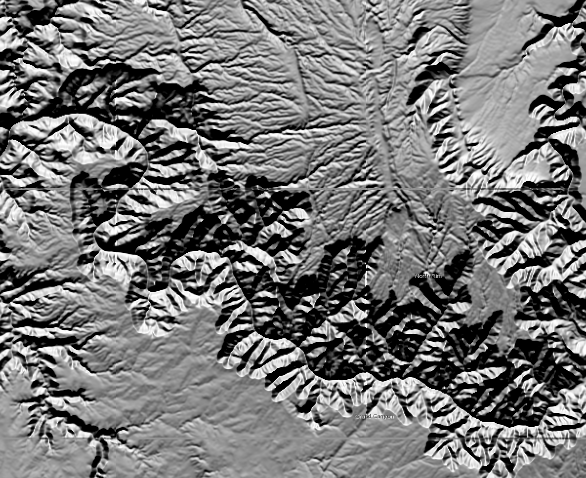 | 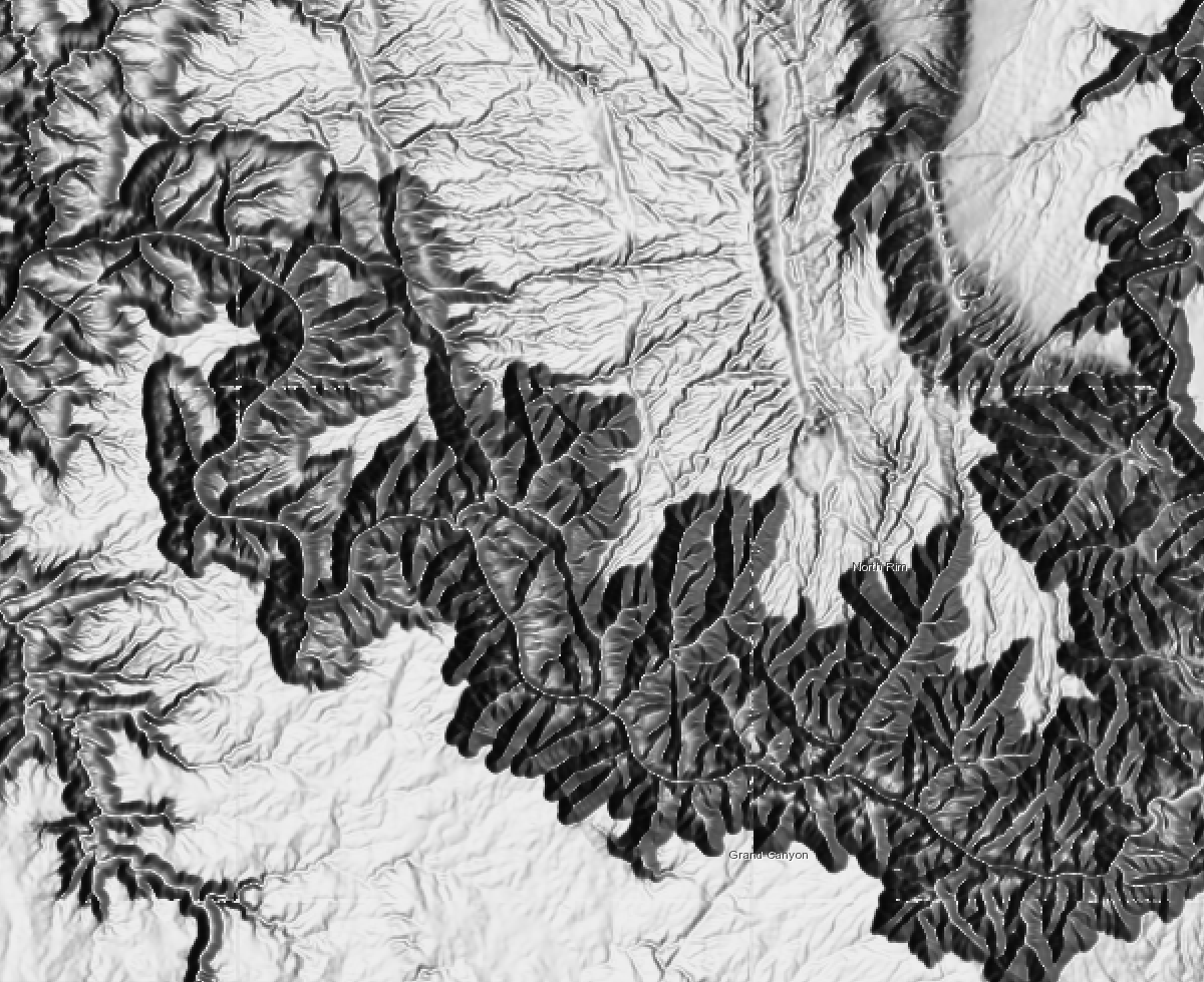 |
Constructors
- new RasterShadedReliefRenderer(properties)
- Parameter:properties Objectoptional
See the properties for a list of all the properties that may be passed into the constructor.
Property Overview
| Name | Type | Summary | Class | |
|---|---|---|---|---|
| Number | The sun's angle of elevation above the horizon, ranging from 0 to 90 degrees. more details | more details | RasterShadedReliefRenderer | |
| Number | The sun's relative position along the horizon, ranging from 0 to 360 degrees. more details | more details | RasterShadedReliefRenderer | |
| ColorRamp | The color ramp to display the shaded relief. more details | more details | RasterShadedReliefRenderer | |
| String | The name of the class. more details | more details | Accessor | |
| String | The type of hillshading being applied on the elevation surface. more details | more details | RasterShadedReliefRenderer | |
| Number | Pixel size factor accounts for changes in scale as the viewer zooms in and out on the map display. more details | more details | RasterShadedReliefRenderer | |
| Number | Pixel Size Power accounts for the altitude changes (or scale) as the viewer zooms in and out on the map display. more details | more details | RasterShadedReliefRenderer | |
| String | Applies a constant or adjusted z-factor based on resolution changes. more details | more details | RasterShadedReliefRenderer | |
| String | The type of Renderer. more details | more details | RasterShadedReliefRenderer | |
| Number | A ratio of z unit / xy unit, with optional exaggeration factored in. more details | more details | RasterShadedReliefRenderer |
Property Details
- altitude Number
The sun's angle of elevation above the horizon, ranging from 0 to 90 degrees. A value of 0 degrees indicates that the sun is on the horizon, that is, on the same horizontal plane as the frame of reference. A value of 90 degrees indicates that the sun is directly overhead.
- Default Value:45
- azimuth Number
The sun's relative position along the horizon, ranging from 0 to 360 degrees. This position is indicated by the angle of the sun measured clockwise from due north. An azimuth of 0 degrees indicates north, east is 90 degrees, south is 180 degrees, and west is 270 degrees.
- Default Value:315
- colorRamp ColorRamp
The color ramp to display the shaded relief. By default, the grayscale is applied.
- Default Value:null
The name of the class. The declared class name is formatted as
esri.folder.className.
- hillshadeType String
The type of hillshading being applied on the elevation surface.
Value Description traditional Calculates the hillshade using an illumination source from one direction using the altitude and azimuth properties to specify the sun's position. multi-directional Combines light from multiple sources to represent the hillshaded terrain. The advantage of the multidirectional hillshade method is that more detail is displayed in areas typically affected by over saturation and deep shadows than when using the traditional hillshade method. Possible Values:"traditional"|"multi-directional"
- Default Value:"multi-directional"
- pixelSizeFactor Number
Pixel size factor accounts for changes in scale as the viewer zooms in and out on the map display. It controls the rate at which the Z Factor changes. This parameter is only valid when the scalingType is
adjusted.- Default Value:0.024
- pixelSizePower Number
Pixel Size Power accounts for the altitude changes (or scale) as the viewer zooms in and out on the map display. It is the exponent applied to the pixel size term in the equation that controls the rate at which the Z Factor changes to avoid significant loss of relief. This parameter is only valid when the scalingType is
adjusted.- Default Value:0.664
- scalingType String
Applies a constant or adjusted z-factor based on resolution changes. The shaded result is scaled dynamically by adjusting the z-factor using one of two options.
Possible Values
Value Description none No scaling is applied. This is ideal for a single raster dataset covering a local area. This is not recommended for worldwide datasets with large variations in elevation or multi scale maps, as it will produce terrain relief with little variation at small scales. adjusted A nonlinear adjustment is applied using the pixelSizePower and pixelSizeFactor values, which accommodate a wide variety of altitude changes (scale) as the viewer zooms in and out. The Adjusted option is recommended when using a worldwide dataset. Possible Values:"none"|"adjusted"
- Default Value:none
- type Stringreadonly
The type of Renderer.
For RasterShadedReliefRenderer the type is always "raster-shaded-relief".
- zFactor Number
A ratio of z unit / xy unit, with optional exaggeration factored in. If the units for the z (elevation) units are the same as the x,y (linear) units, then the z conversion factor is 1. If your dataset is using a projected coordinate system and your elevation and linear units are different, then you will need to define a z conversion factor to account for the difference.
- Default Value:1
Method Overview
| Name | Return Type | Summary | Class | |
|---|---|---|---|---|
| RasterShadedReliefRenderer | Creates a deep clone of the renderer. more details | more details | RasterShadedReliefRenderer | |
| * | Creates a new instance of this class and initializes it with values from a JSON object generated from a product in the ArcGIS platform. more details | more details | RasterShadedReliefRenderer | |
| Object | Converts an instance of this class to its ArcGIS portal JSON representation. more details | more details | RasterShadedReliefRenderer |
Method Details
- clone(){RasterShadedReliefRenderer}
Creates a deep clone of the renderer.
Returns:Type Description RasterShadedReliefRenderer A deep clone of the object that invoked this method. Example:// Creates a deep clone of the first layer's renderer var renderer = view.map.layers.getItemAt(0).renderer.clone();
- fromJSON(json){*}static
Creates a new instance of this class and initializes it with values from a JSON object generated from a product in the ArcGIS platform. The object passed into the input
jsonparameter often comes from a response to a query operation in the REST API or a toJSON() method from another ArcGIS product. See the Using fromJSON() topic in the Guide for details and examples of when and how to use this function.Parameter:json ObjectA JSON representation of the instance in the ArcGIS format. See the ArcGIS REST API documentation for examples of the structure of various input JSON objects.
Returns:Type Description * Returns a new instance of this class.
- toJSON(){Object}
Converts an instance of this class to its ArcGIS portal JSON representation. See the Using fromJSON() guide topic for more information.
Returns:Type Description Object The ArcGIS portal JSON representation of an instance of this class.